http://www.bio-medicine.org/biology-news/Envisat-and-ERS-2-reveal-hidden-side-of-Hurricane-Rita-1262-3/
Envisat and ERS-2 reveal hidden side of Hurricane Rita
Another Envisat instrument called the Radar Altimeter-2 uses radar pulses to measure sea surface height (SSH) down to an accuracy of a few centimetres.
Near-real time radar altimetry is a powerful tool for monitoring a hurricane's progress and predicting its potential impact. This is because anomalies in SSH can be used to identify warmer ocean features such as warm core rings, eddies and currents.
[Jeff King, Tom Bearden, Richard Hoagland on Hurricane anomalies]
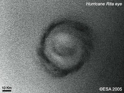
Rita's eye displays a distinct pentagonal symmetry -
This is soon after Rita entered the Gulf of Mexico, about the period of time that it accelerated very quickly from a class-2 to a class-5 storm. Experts say that this transition happened over a period of (~12) hours rather than the several days to be expected if warm surface water was the only energy source.
...
[ more ]
physics forum discussing "Hyperdimensional Katrina" concept: http://www.physicsforums.com/archive/index.php/t-91420.html